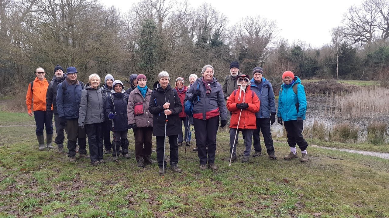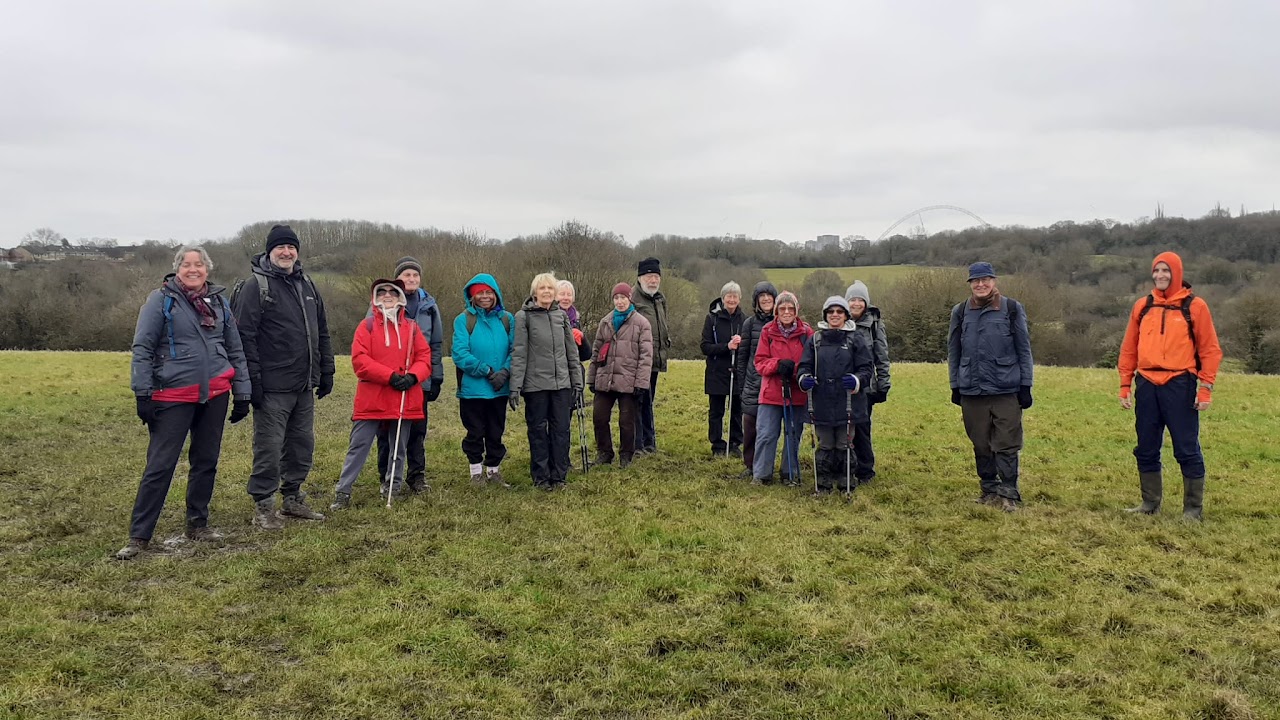
17 Poly Ramblers assembled outside Northwick Park Met line station, this cold February morning. There was a very weak hazy sun at the start, soon disappearing, and leaving a gloomy greyness for the rest of the day. The ramble takes us through the middle of Kingsbury where I lived from the age of 5 (1961) to 27 (1983) so there was much nostalgia for me.
We set off southwards along the edge of Northwick Park playing fields, beside a University of Westminster site and Northwick Park hospital. This is the Proyers Path which takes us eastward into houses and underneath the North Western Main Line & Lioness Line at South Kenton station. On the other side of these lines along Windermere Avenue runs a parallel small parade of shops, and we continued through these quiet residential streets to enter and cross the recreation ground of Preston Park. We continued further eastward to pass Preston Road station. Proceeding into Uxendon Crescent, we passed under the Jubilee line overbridge and left into Uxendon Hill. Before the houses arrived in the early 1930s this was the site of the former Uxendon Farm and hamlet. We are now walking beside rows of semi detached houses typical of Metroland. There was one particular house in Uxendon Hill that had not been refurbished and looked quite delapidated. I advised the party to look beyond all its delapidations, and pointed out its thick wooden window frames and odd bits of stained glass (e.g. landing window at side), and pebble dash finish. Back in the thirties nearly all the houses in Uxendon Hill would have looked like this when the street was new, in the then Borough of Wembley.
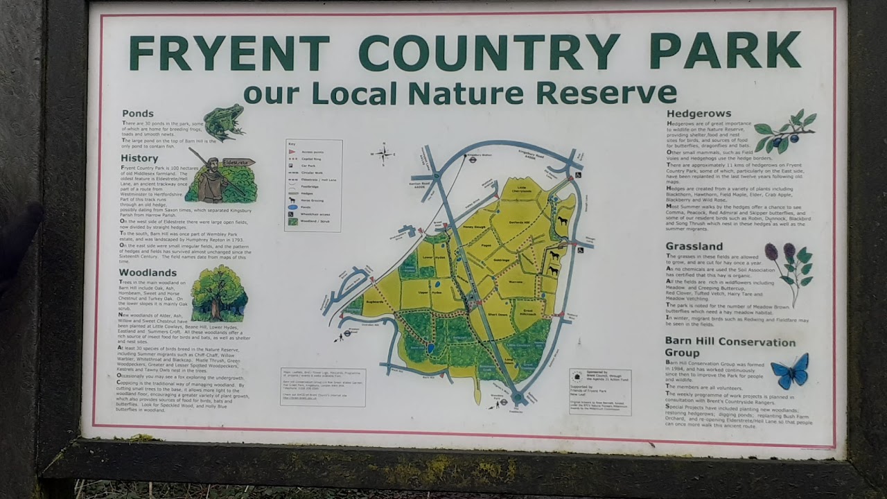
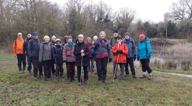
Further on, a side footpath between 2 houses led us into a small strip of woodland. This opened out into Fryent Country Park, bounded on the left by the Jubilee line. The ground in this Park was extremely muddy, so having done a walkover in advance, I had to advise the party to essentially wear boots and bring poles! To the right of the opening was the footpath leading up to Barn Hill, the first of two summits in this Park. On the top of Barn Hill, there is a trig point (86m) and it is semi wooded with small open areas and a pond. We gathered on the seats around the pond to eat our picnic lunches.
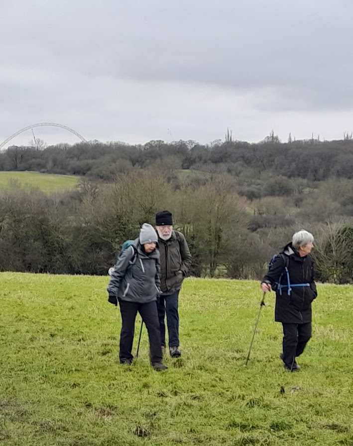
From Barn Hill is a clear view of Wembley Stadium Arch to the south. There are other views of St Paul’s Cathedral and city skyscape to the south east. It was slightly hazy so this wasn’t all that prominent. If the weather is really clear you can see all the way down to the North Downs to the south. During the 1970s this is where I would take our family pet labrador, Simon, for a run out. We came across several dogs taken out during our visit here.
Being a cold day we moved off again within a hour, negotiating a rather tortuous slippy path down the wooded north slopes. Then a right turn along the lower edge of the wood took us across Eldestrete (pronounced Elderstreet?). This is an ancient road from pre-Roman times used by pilgrims to St Alban’s shrine. This is probably how the nearby cul de sac called Pilgrims Way, (which I knew as an estate of Prefabs in the 60s and 70s), got its name.
At a car park we crossed the busy thoroughfare of Fryent Way being the A4140 road to Stanmore. Fryent Country Park now continues on the other side and has done since the early 1980s. Fryent Way was a route I would often take walking home from school in the early to mid 70s, in order to save my bus fare! In those days the parkland east of Fryent Way was still being farmed (Big Bush and Little Bush Farms) and thus fenced off from the public. At times non dairy cattle would be seen grazing in these fields, behind fencing beside the pavement. But now in 2025 this parkland was very squelchy and puddly, and we took care keeping to the drier bits. We then climbed north-westwards to the second summit, Gotfords Hill, at 62m. It offered some views of northern Kingsbury, so a good place for a photoshoot. From here we continued along much muddy grass, south-westwards beside Bush Farm stables, and finally out of the Park, along the muddiest path of the day between some houses and into Salmon Street.
At this point I took a small diversion from the Capital Ring, going downhill along Mallard Way to Church Lane at the lower end. This enabled a direct shorter route to the George Public House in Church Lane, where we could all have a refreshment drink and warm up indoors. We spent most of an hour inside. The access to its cloakrooms inside amused me. Men had to pass through the door of a cut out red public phone box, whereas Ladies had to pass through the door of a cut out navy blue police public callbox.
Church Lane outside gave me memories of walking to and from my infant/primary school during the early to mid 60s, including the severe winter of 1962-63, being my first awareness of seeing frost on grass and willow trees, and particularly high snowfalls that winter, with snow/ice cover continually from about Boxing Day to Mid March!
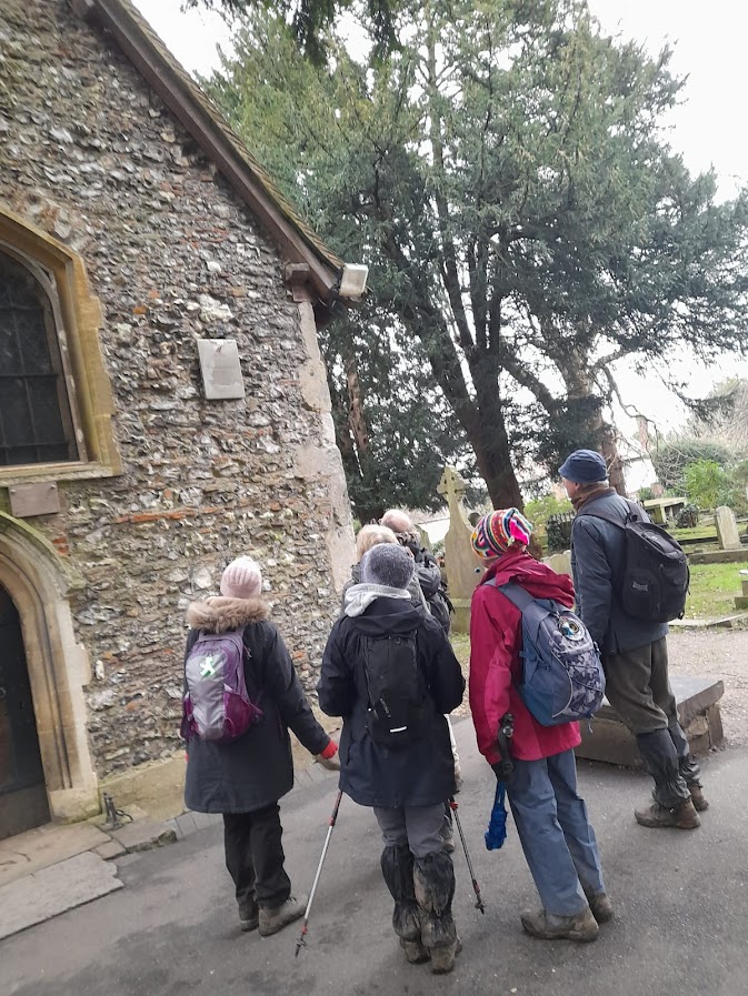
On leaving The George we proceeded south along Church Lane. When we reached an alley taking us into Wells Drive, we were back onto the Capital Ring, and continued to St Andrews Church. This is a Victorian building in white stone and was originally located in Wells Street in London’s West End, where it was erected in 1847. It stands high with an interior giving the impression of a small cathedral. Between 1931 and 1933 it was moved to Kingsbury brick by brick, due to falling congregation numbers in Wells St and growing numbers due to the extensive house building in Kingsbury. I explained to the party that it was exactly 60 years ago in early 1965 that I joined the church choir here!
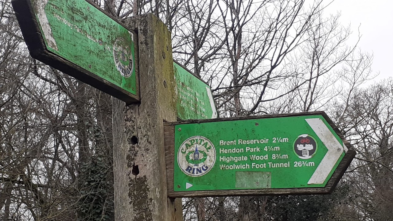
We proceeded into the cemetery beside the church, reaching the former smaller old St Andrews church, amongst shrubs and yew trees. This has been largely unused, but during the 1960s when the choir was on summer break, it hosted Evensong services during August. It dates back to Saxon times, and at about the turn of the millennium, transferred to the Redundant Churches organisation. Continuing out of the churchyard, we proceeded into Birchen Grove and onto a metalled footpath eastward, following the banks of the Brent Reservoir, also known as the Welsh Harp. We stopped occasionally to see wildlife on the shores. This path took us into Cool Oak Lane and Cool Oak Bridge (currently closed to traffic). Cool Oak Lane lives up to its name as it is rural on each side and flanked with rows of oak trees to make it shady in summer. I have pleasant memories travelling along this lane almost daily, to and from work, when I had my first car (Volvo saloon) in 1979-83. Especially as that journey was only 2.5 miles!
Once over the bridge we entered West Hendon. When I asked the party if anyone wanted to get the bus to Brent Cross for tea in John Lewis, they nearly all declined, and it was beginning to get dark. So, all but about 2 finished the walk with me at Hendon Thameslink station, around the corner. The remainder, I believe, caught a bus in West Hendon Broadway.
Thanks to all those who attended.
GEOFFREY. Photos by Geoffrey, Joyanna and Hilary